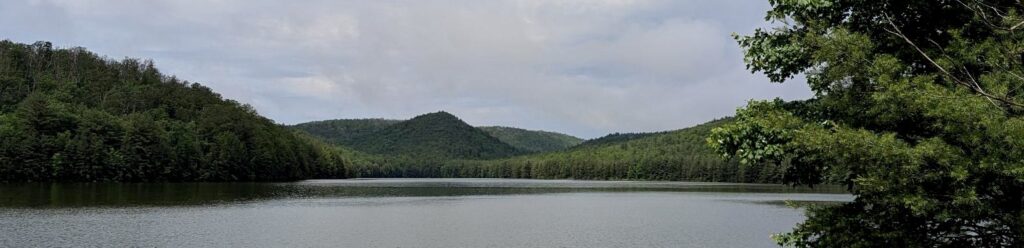
Between Ridge Rd and Long Pine Reservoir in Michaux State Forest, there is a well known orange-blazed trail called Rocky Knob. The trail climbs both Rocky Knob and Sier Hills, and is named for the shorter of the two. At 1857’, Rocky Knob is visible from the parking lot at the Long Pine Reservoir boat ramp.
Sier Hill (1923’) is directly behind Rocky Knob in this photo, so we’ll have to go see it in person. You can start this hike from the parking lot at the north end of the reservoir – the lower spur is pretty rocky, similar to the trail sections of the loop. It climbs along the bottom of Knob Hollow, through a rhododendron forest before meeting up with the main trail. If you are already at the reservoir, or you are coming from east of Rt 233, starting at this end may make sense for you. The trailhead is directly opposite Beaver Trail, along Birch Run Rd.
I like to start Rocky Knob from the upper spur on Ridge Rd, mostly because it’s faster to drive to from Ship. The trailhead is about 2 miles south of Shippensburg/Baltimore Rd on Ridge Rd, and has a parking lot for about 6 cars. When it’s nice out, especially on a fall weekend, there can be a dozen or more cars, parked in the lot and along the road. There’s room for everyone, but try to stay out of the mud if you have to park along the road.
From the lot, you’ll head just slightly uphill on a wide trail that feels like it used to be a forest road. You’ll cross the Appalachian Trail, which runs along South Mountain from Maryland through Mt Holly Springs. If you take the AT from here, you’ll find the Birch Run shelter is to your left, or Quarry Gap to the right. Stay straight for Rocky Knob, and you’ll soon pass a closed camping area along the Camps Trail.
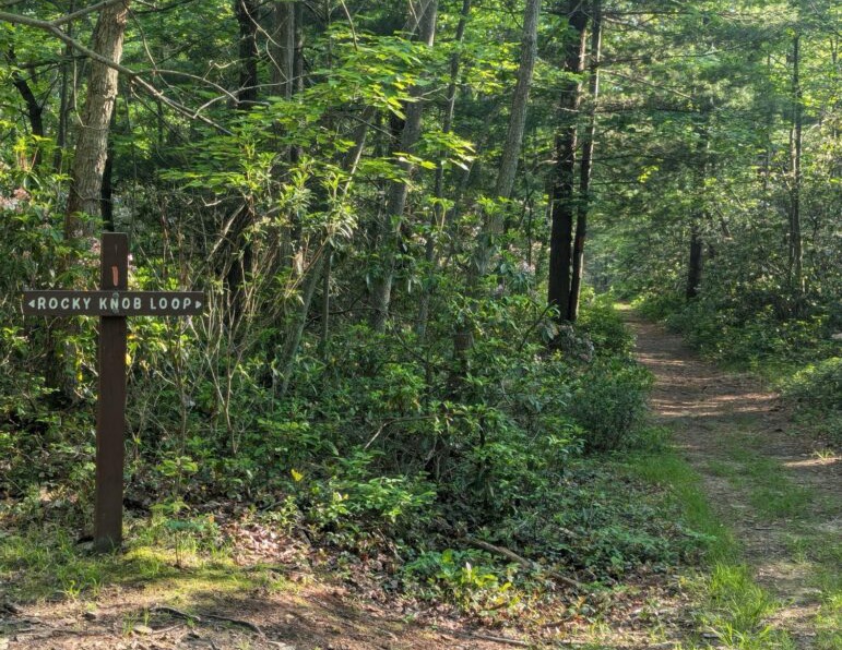
Keep straight on the wide flat road and you’ll come to another intersection, where the Rocky Knob loop starts. This is the end of the upper spur. You can go left if you want to do the trail section first, or stay straight to do the road section first. The two sections couldn’t be more different, and that makes the choice easy for me – I stay to the right, on the road, as it descends into the hollow formed by Knob Run.
The roadbed trail is flat and wide as it follows the creek around Sier Hill, and loses about 400’ headed to the base of Rocky Knob. This is very pleasant walking with no stairs, no rocks, and good footing. Heavy rains do have a tendency to flush a lot of leaves and pine needles onto the road, but it drains well and mud is minimal. Being such nice easy walking makes me really dislike walking up this way. It’s just boring, and while I’m headed up, I’d rather have something interesting to do with my feet.
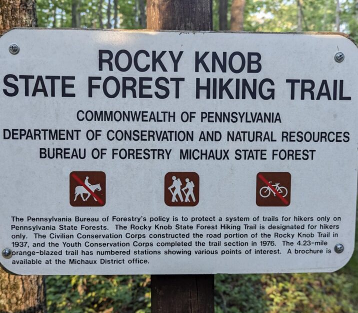
On the way to the lower spur you will encounter a few numbered posts, which were set up by the YCC in the 1970’s to mark features and wildlife. Unfortunately, the posts haven’t been updated in many years, and the brochure linking the numbers to the information is no longer available on the DCNR website. Though the meaning is lost, I enjoy calling out the numbers as I pass the posts. There are 12 in total.
This signpost at the bottom of the road section marks the top of the lower spur, a rocky section that winds along the creek through a stand of rhododendron. If you wore a jacket or long sleeves, now is the time to strip em. It’s not all uphill from here, but there’s not much down.
From the lower spur, you’ll head uphill and leave the nice easy road. The trail section is rocky single track, the steeper parts of which often turn into cascades in heavy rain. The first climb will take you up about 200 feet along the side of Rocky Knob, though the summit is another 150 feet or so. There’s a #8 signpost if you want to go there – the side trail to the top is currently blocked by a fallen tree. There’s not really a view, but the rocks are cool. Keep to the left to stay on the loop trail.
After partially climbing Rocky Knob, you’ll come upon a small campsite, in the flat spot between the two hills. This is a dispersed site, so if you hauled your camping gear here from the parking lot, you can camp here without a permit. It’s rare to see someone at this site, but all dispersed camping in Michaux is first come, first served. If you’re taking it nice and slow, this is a great spot for a break, or to let your party catch up.
The second hill on this loop is Sier Hill. It’s a little higher than Rocky Knob, but we’re already halfway up, since we climbed most of the way up Rocky Knob. This is the steepest part of the loop, but the elevation change is almost the same as the one you just did.
About halfway up this hill, you’ll find a tall stump, just the perfect height to use as a temporary walking stick.
This post means you’re about halfway up Sier Hill, and it’s about to get steeper at that left turn.
If you climb these hills much, and especially if you’re using them to get in shape, you may find this post helpful. It accepts prayers, wishes, and even a little whining.
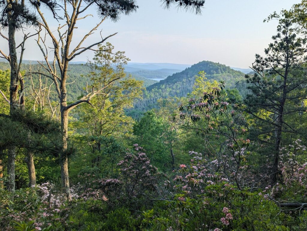
You’ll reach the top of Sier Hill and the forest will change to moth-killed oak. You’ll be able to see across to Strasbaugh Hill on the other side of Birch Run Rd, and there is another dispersed campsite here. The trail (and the campsite) is especially rocky, predominately limestone trying to bend your ankles every which way. Take it slow, enjoy the view along the ridge.
After crossing a small hollow, there is a bench at an overlook spot about a half mile or so after the peak of Sier Hill. The bench is new, the signpost used to mark a number 6. You can see the Long Pine Run Reservoir from here, mirroring the view from earlier.
From the bench, you’ll continue along the ridge for another quarter mile or so, then a left turn will bring you back under the canopy as you head towards the road section. You’ll walk through some more heath forest, into Cumberland County and past a couple of chestnut trees, on the way to close the loop.
Back on the old road. Keep right this time, so that you cross Camps Trail and the Appalachian Trail, and you’ll end up back at the parking lot. AllTrails, Apple Fitness and Garmin all argue about the exact length, but the sign is close enough – it’s right around 4.23 miles.
I’ve done Rocky Knob when it was covered in ice, as well as when it’s 95ºF. Rain, snow, mosquitoes, hunting season, even twice at night. It’s good for ya, and I’d love to see ya out there.